US 25 Improvements from Corbin (US 25E) to London (KY 1006)

Project Purpose and Need:
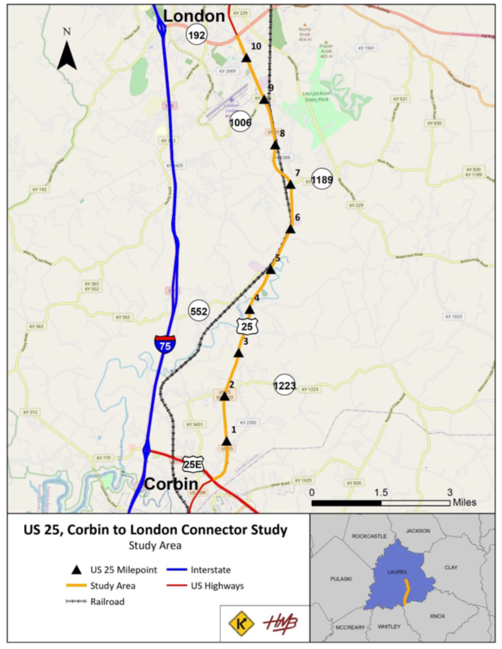
The purpose of this project is to enhance safety, connectivity and mobility for vehicles along US 25 between US 25E and KY 1006. The project will construct a modern, efficient roadway that improves access for residents traveling to businesses, schools, and other destinations in Laurel County. This project aims to modernize the corridor by bringing it up to current geometric and design standards, ultimately creating a safer, more reliable connection between Corbin and London for drivers in these growing communities.
Project Timeline:
Public Hearing Tentative July, 2026
The project is currently in the Preliminary Design phase, during which public input is being gathered to help select a preferred alternate for future development. The Final Design phase – where detailed plans are created- is expected to take approximately 18 to 24 months. If funding is allocated in the next Highway Plan, the Right of Way phase could begin as early as 2027 following completion of the detailed design. At this time, no construction start date has been established.
Questions or Comments:
The project manager is Sherri Chappell, PE. She can be reached at sherri.chappell@ky.gov or 502-765-0250.
Important Links/Documents:
Proposed Alignment (Preliminary – Subject to change)
Property Owner/Residents Letter
Property Owner Questionnaire
Property Owner Archaeology Letter
US 25 Planning Study Summary
