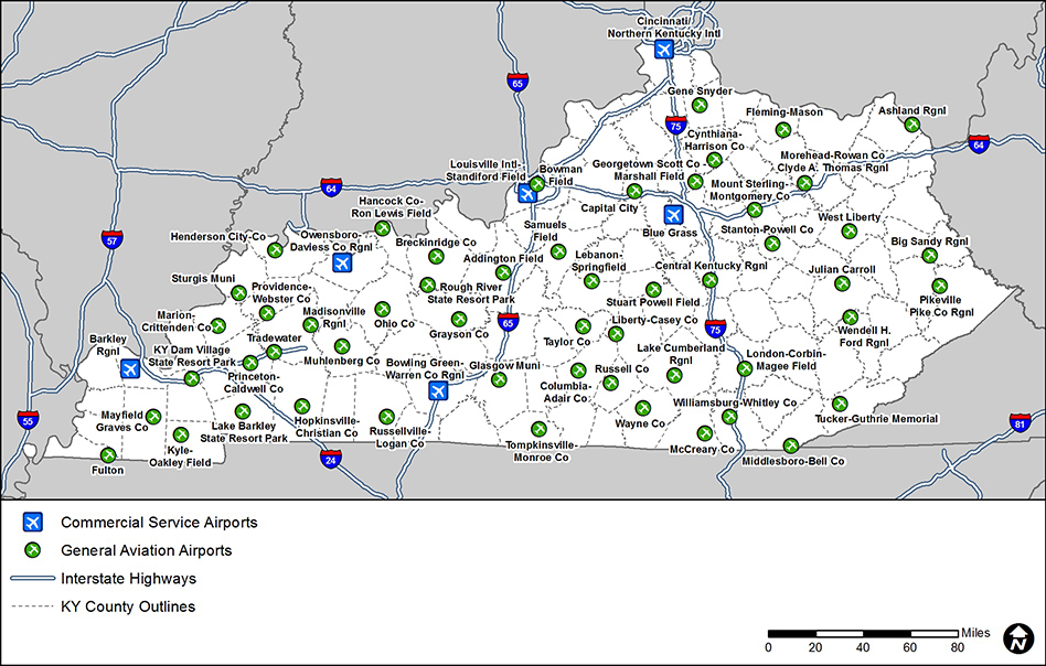
Interstate 65 in Louisville will close between the Watterson Expressway (I-264) and downtown Louisville (Jefferson Street) from June 1- July 31 to speed progress on replacing 3 aging bridges.
The closure will save at least a year of construction restrictions, and a signed detour will be in place. Local street closures and ramp closures will also be needed.
Learn more at I65CentralCorridor.com.

Airport System Map

This map depicts the 59 airports evaluated in the Kentucky SASP. Five of these airports provide scheduled commercial airline flights and are labeled as Commercial Service Airports. The other 54 airports are labeled General Aviation Airports. The study team plans to update this map with airport roles as the SASP progresses.

ky-sasp-systemmap.jpg 

Department of Aviation

Airport Zoning Commission

Department of Rural and Municipal Aid

Local Programs
Local Public Agencies

Department of Vehicle Regulation

Drive.ky.gov
Motor Vehicle Commission

Powered by Google TranslateTranslate